Anti-Drone Systems Enhance Low Altitude Airspace Safety Management
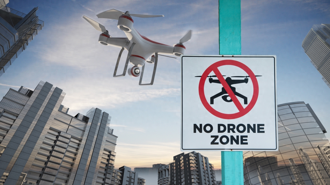
On August 26, 2024, various websites, including Air Traffic Management, reported that low-altitude airspace managers have been seeking to develop Unmanned Aerial Traffic Management (UTM) or U-space ecosystems for years, allowing drones and electric vertical takeoff and landing (eVTOL) aircraft to fly beyond visual line of sight (BVLOS) safely. The critical question is how to ensure that drones and electric aircraft operating within their airspace are properly authorized and not under the control of the uninformed, careless, criminals, or, at worst, terrorists. To address this technological and regulatory challenge, anti-drone systems must be integrated into airspace management to detect non-compliant drone operations at early stages and mitigate potential issues.

Globally, over 300 anti-drone companies offer such systems; however, due to the unique characteristics of each UTM/U-space geographical region, most systems are incompatible in terms of effectiveness and cost-efficiency. For instance, if a UTM/U-space area overlaps with critical security regions such as airports, seaports, or prisons, the required detection and mitigation technology levels may differ from those in rural areas.
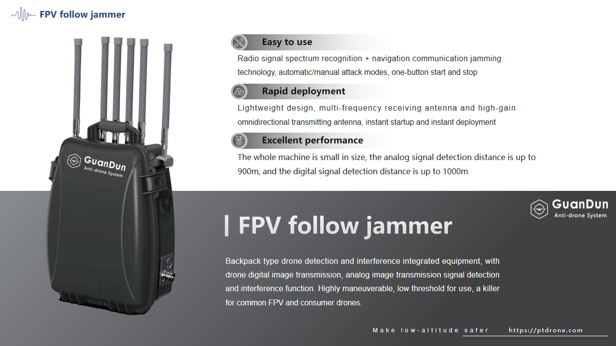
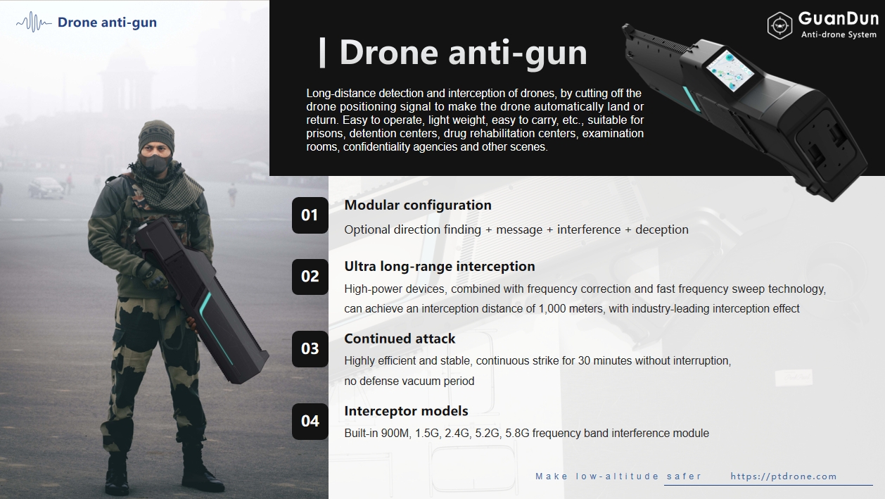
The ideal anti-drone solution is "layered," employing multiple sensors like radar, radio frequency detection, acoustics, and optics. These sensors' information is integrated into a command and control system, enabling operators to receive early threat warnings, identify intentions, and choose the best mitigation systems: radio frequency jamming, information spoofing, network takeover, laser weapons, kinetic response drones, network capture systems, small missiles, or artillery. Furthermore, as drone threats evolve, new sensors and mitigation measures need to be scalable.
Installing such a layered anti-drone solution should achieve at least 95% effectiveness against all drone threats, though costs can reach millions of dollars. According to a recent report from Statista, “the municipal airspace customer cost for civil anti-drone hardware was $5 million, with annual ordering costs of $1.7 million in 2020.”
UTM/U-space geographical area managers also face other challenges. Their current work is limited to detecting rogue drones, while appropriate mitigation measures should be deployed by national security agencies. Consequently, there is a disconnect between the agencies responsible for ensuring low-altitude airspace safety, with roles and responsibilities often unclear.
However, the situation may not be as dire as many once feared. New regulations, technologies, and a renewed understanding of associated risks are making this challenge easier to address.
Nature of the Threat
At the core of the challenge is understanding the nature of the threats. Most UTM ecosystem managers will not need to invest in deep defense networks to protect against military-grade and autonomous drone attacks to avoid detection—at least, not yet.
Commercial drones still pose a considerable threat to UTM/U-space geographical area managers. According to a 2020 RAND Corporation report titled “Small Unmanned Aerial System Adversary Capabilities”: “Overall, the commercial small unmanned aerial systems market is trending towards smaller, lighter, and harder-to-detect models. Furthermore, there are significant improvements in speed, range, and endurance, along with reduced acoustic signatures. Certain models of small drones possess sufficient payload capacity to carry large explosive materials or illegal items. However, they are relatively easy to detect as they transmit command control and telemetry data in the radio frequency (RF) spectrum.
Initial Measures
The first line of defense is mandating that all commercial drones be equipped with remote identification systems that allow security agencies to understand the drone's serial number/registration number, geographical location, and ground control station location. Japan has mandated remote identification systems for drones since June 2022, while the U.S. Federal Aviation Administration (FAA) set a deadline of September 16, 2023, for drone identification systems. The European Union will begin implementation on January 1, 2024, though the information requirements vary among regulatory agencies.
Jeff Cole, CEO of U.S. urban anti-drone company Hidden Level, stated, “Existing air traffic systems and monitoring infrastructure have been used for decades to monitor manned aircraft but were not designed for low-altitude tasks above urban areas. We must monitor potentially hundreds of drones and urban air vehicles. While the FAA's remote ID requirements are helpful, they have limitations. The role of remote ID is similar to an identifiable license plate and the transmission of drone location. However, remote ID signals can be spoofed or not transmitted at all, leading to verification needs.”
In early 2023, new UTM/anti-drone system integration technologies and cloud-based solutions emerged to address the challenge of rogue drones. Detection systems work alongside UTM systems to track both cooperative and non-cooperative drones. Hendrik-Jan Van Der Gucht, General Manager of Belgian UTM company SkeyDrone, stated, “Just as air navigation service providers must invest in ATM systems (including flight planning) as well as major cooperative detection technologies (e.g., Mode-S radar and ADS-B) for flight tracking systems, we as U-space service providers also have this obligation. Risk assessments will determine where additional components are needed to manage safety and security risks posed by unauthorized and non-cooperative drone operations. Our integrated detection systems for cooperative/non-cooperative drones allow safety and security personnel to focus on high-risk, unauthorized drone flights.”
SkeyDrone Solutions
In February 2023, SkeyDrone launched Radar Pro with anti-drone hardware partners to construct a radio frequency-based detection system fully integrated into the UTM/U-space ecosystem. Sales Director Didier Decaestecker explained, “You need a detection network capable of identifying and tracking drones, and our system serves U-space front-end services for geographic areas and drone operators. It can detect both cooperative and non-cooperative drones while integrating UTM system flight authorizations, allowing security or geographical area managers to immediately see which drones are authorized in advance and which are not.”
In April 2023, Dedrone introduced the City-Wide drone detection solution in 40 major cities worldwide. This cloud-based solution allows for fixed location and mobile monitoring through networks, App Store, and Google Play.
Chief Marketing Officer Mary-Lou Smulders stated, “Dedrone's City-Wide drone detection solution is an example of how anti-drone technology can be easily implemented. The system utilizes existing infrastructure to monitor multiple drones and geographical areas simultaneously through a simplified alert system. Once an alert area is breached, the system notifies operators of the location and specific data about the drone. Enhancements using cameras or radar, among other tools, to bolster airspace safety are also easily implemented.”
The advantages of next-generation cloud-based remote anti-drone systems as a service include increased cost-effectiveness, scalability, and flexibility. Utilizing artificial intelligence (AI) technology, they can quickly identify drone types (based on known commercial drone databases) and the operator's location, classifying threat types by simulating their behavior. New sensors can be quickly added to the network, ensuring that it evolves to meet future threats.
Hidden Level Solutions
Jeff Cole, CEO of Hidden Level, stated, “At Hidden Level, we have developed multi-purpose sensing technologies to meet market demands for drone and manned aircraft detection. Most commercial applications adopt our data-as-a-service model, deploying our sensing technologies over existing infrastructure to create coverage, which can be expanded by adding more sensors through layered installation. We own and operate the hardware, alleviating the cost and maintenance burden for clients. Multiple users can subscribe to the same network, creating a shared operational picture that is also cost-effective.”
Regarding the necessity of spending $5 million to purchase a city airspace anti-drone system, while this was the case in 2020, costs have significantly decreased since then.
In February 2023, OSL, a UK company, implemented an anti-drone system at London Heathrow Airport, releasing the Drone Alert Service (DAS), an intuitive detection system that requires no hardware and is available through various subscription services. This allows users to receive alerts about drone activity in their vicinity and view three years of historical data, with a subscription price of only £24 per day. However, technical challenges remain. Integrating anti-drone systems with UTM systems is a significant challenge, and adding new sensors to address threats is also a major hurdle. A potential larger challenge is how to handle a detected drone. This requires a series of technological and institutional solutions, with technical challenges proving less formidable than institutional ones.
Responsibility
Countries are finally beginning to consider who is responsible for handling drones once detected. In Europe, the European Commission's anti-drone systems package plan is taking shape with the support of its Joint Research Centre in Belgium and Italy. The proposal envisions establishing a digital drone incident platform, including categorized data shared by EU-authorized users, methods for testing and evaluating anti-drone systems, compiling annual reports on anti-drone technology development, and providing risk assessments for mitigation strategies.
In the United States, the FAA published the "Interagency Coordination Process Report on Anti-Drone Systems" in March 2023, explaining how the Department of Defense (DOD), Department of Energy (DOE), Department of Justice (DOJ), and Department of Homeland Security (DHS) will coordinate to tackle anti-drone challenges. The report concluded that “these five agencies spent eight months developing components, roadmaps, and objective standards for using drone systems to detect and mitigate systems. During this period, they overcame several challenges, including determining the extent to which drone system detection and mitigation would interfere with the National Airspace System (NAS) and what processes are needed to standardize coordination processes.” The FAA's National Security Projects and Incident Response Office is also testing drone detection technology at Atlantic City Airport.
Potential UTM/U-space service providers are not waiting for regulatory agencies to establish detailed rules for the deployment of UTM/anti-drone integrated services; instead, they are becoming proactive. Hendrik-Jan Van Der Gucht noted, “From a commercial perspective, the services
Integer maximus accumsan nunc, sit amet tempor lectus facilisis eu. Cras vel elit felis. Vestibulum convallis ipsum id aliquam varius. Etiam nec laoreet turpis. Aenean nisi libero, tempor non sem vitae, hendrerit egestas ex. Nam magna odio, placerat ac risus tristique, viverra tincidunt nibh. Donec vitae leo efficitur, bibendum nibh ac, pretium urna. Vestibulum nunc augue, scelerisque ac vulputate sed, fermentum non nisi.
Vivamus tristique ligula quis orci malesuada tincidunt. Praesent magna purus, pharetra eu eleifend non, euismod vitae leo. Interdum et malesuada fames ac ante ipsum primis in faucibus. Quisque sapien enim, feugiat et mi vel, fermentum placerat tortor.
Praesent suscipit, purus tincidunt faucibus gravida, leo quam ullamcorper risus, quis pretium nibh eros ut purus. Vestibulum ante ipsum primis in faucibus orci luctus et ultrices posuere cubilia Curae; Fusce ut enim tempor, venenatis metus interdum, ullamcorper sem. Pellentesque et sem vehicula, condimentum velit malesuada, dapibus nunc. Duis vitae eleifend orci, ut varius risus. Praesent consequat nibh id dictum molestie.
- Vestibulum iaculis velit
- Nec ante varius tempus
- Duis sollicitudin lacus sapien
- Sed pharetra felis facilisis sed
Cras eget sapien auctor, porttitor nisi vitae, vulputate justo. Cras et pharetra ligula, vel vestibulum ipsum. Orci varius natoque penatibus et magnis dis parturient montes, nascetur ridiculus mus.


Make it simple, but significant
Quisque scelerisque suscipit purus, nec venenatis nulla lobortis eu. Interdum et malesuada fames ac ante ipsum primis in faucibus. Suspendisse tempor id lacus in tincidunt. Vestibulum porttitor risus diam, nec ullamcorper leo consectetur luctus. Praesent neque nisi, eleifend sed diam sed, ultrices venenatis ipsum. Vestibulum ut sem urna. Mauris lorem neque, egestas eget arcu sit amet, sagittis dictum risus. Sed dolor ligula, dictum ac mattis nec, sagittis non ipsum. Integer sollicitudin nunc vitae nisi facilisis, sed rutrum elit vestibulum. Duis viverra maximus felis at condimentum. Sed congue mi vel massa laoreet, vel laoreet risus sollicitudin. Ut pellentesque est lectus, vitae sodales velit tempus eget. Aenean sem quam, malesuada non venenatis non, porta et magna. Donec nec urna eget sapien ornare tristique. Quisque ac accumsan leo. Curabitur elementum ligula in libero dictum, eu placerat lacus posuere.


